Severe Weather Outlook
Hayley here - Do you like lofi music and terrifyingly loud computer voices? Then stop by the 24/7 ish severe weather live stream!
Outlook for Tuesday, July 1
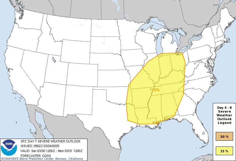
Outlook Images
Note on Medium Range Outlooks
You are looking at an outlook that is part of the medium range forecast (the outlook for days 4-8). The most important thing to note is that lack of a risk does not mean zero risk. Generally speaking, confidence has to be pretty high for the Storm Prediction Center to have an outlook area this far into the future.
When no specific risk areas are shown, you might see one of these phrases:
- Predictability Too Low: This means that severe storms might be possible, but forecasters aren't confident enough about where or when they might occur. Think of it as the models showing different possibilities, like pieces of a puzzle that haven't come together yet.
- Potential Too Low: This means forecasters are fairly confident that widespread severe weather is NOT expected on that day. While isolated storms might still occur, the chance of reaching severe criteria across any given area is very low.
If you bookmark this page, it will continue to update with each new outlook that is issued.
Days Covered in this Outlook
| Day 4 | Saturday, June 28 | low / uncertain |
| Day 5 | Sunday, June 29 | predictability too low |
| Day 6 | Monday, June 30 | predictability too low |
| Day 7 | Tuesday, July 1 | predictability too low |
| Day 8 | Wednesday, July 2 | predictability too low |
Detailed Outlook
ZCZC SPCSWOD48 ALL ACUS48 KWNS 250829 SPC AC 250829
Day 4-8 Convective Outlook NWS Storm Prediction Center Norman OK 0329 AM CDT Wed Jun 25 2025
Valid 281200Z - 031200Z
DISCUSSION
Models are in general agreement with the upper air pattern, but increasing spread is seen from Sunday/D5 and beyond.
On Saturday/D4, a low amplitude wave will lift out of the ND/northern MN vicinity and move into Ontario. This will result in temporary height rises during the day before gradual falls occur overnight and into as a secondary wave moves from MT into the Dakotas overnight. Early day storms may exist over parts of northern MN in association with the low-level jet, and this activity could weaken during the day. Then, strong instability is forecast for several models, perhaps MUCAPE to around 5000 J/kg, over eastern SD and NE and into IA and MN. Heating within the surface trough may spur afternoon development from SD into NE, with some potential for activity to spread east/northeast. However, shear will likely be weak, with 500 mb winds averaging around 15 kt. Despite very strong instability, the weak-forcing situation in the wake of the exiting wave suggests low-predictability at this time.
Around Sunday/D5, the secondary wave is forecast to amplify across the upper MS Valley and upper Great Lakes, with a cold front pushing south and extending roughly from WI to NE. Strong instability will likely exist ahead of such a boundary, though shear will again be weak. Still, storms will likely develop across the region, with areas of damaging gusts potential.
From Monday/D6 through Wednesday/D8, the aforementioned trough will spread across the Great Lakes and Northeast, with what appears to be an end to the extreme instability levels. Scattered storms will likely persist over much of the Southeast and Mid Atlantic, with sporadic strong gusts daily.
..Jewell.. 06/25/2025
CLICK TO GET WUUS48 PTSD48 PRODUCT
National Risk Overview
- Thursday, June 26
- TORNADO: 5%
- HAIL: 5%
- WIND: 15%
- Friday, June 27
- TORNADO: 2%
- HAIL: 15%
- WIND: 15%
- Saturday, June 28
- ANY SEVERE: 15%
- Sunday, June 29
- ANY SEVERE: predictability too low
- Monday, June 30
- ANY SEVERE: predictability too low
- Tuesday, July 1
- ANY SEVERE: predictability too low
- Wednesday, July 2
- ANY SEVERE: predictability too low
Your Severe Outlook
Hey, it looks like your location wasn't detected.
Drag the marker on the map and we'll show you the severe weather potential for a given location.
Hi, I'm Hayley. Did you know that I run this site out of my own pocket? So if you'd like to help out and you're already planning on buying something off of Amazon, why not use our Amazon Severe Weather Outlook link before you buy and we'll get a tiny portion of your purchase.
About Severe Weather Outlook . com
SWO started as a spinoff project of wickedwx, but has since replaced the site.
- tornado hq - live severe weather warnings
- cyclocane - hurricanes/typhoons/cyclones
- tornado solitaire - play cards while you monitor the US severe weather threat
- tertremo - live view of earthquakes around the world
- earthquake solitaire - get live earthquake updates as you play your favorite card game


