Severe Weather Outlook
Hayley here
- Do you like
lofi music
whatever music Hayley put on
and terrifyingly loud computer voices? Then stop by the 24/7 ish severe weather live stream!
* stats delayed and were probably not accurate to begin with
Outlook for Sunday, July 27
Outlook Summary
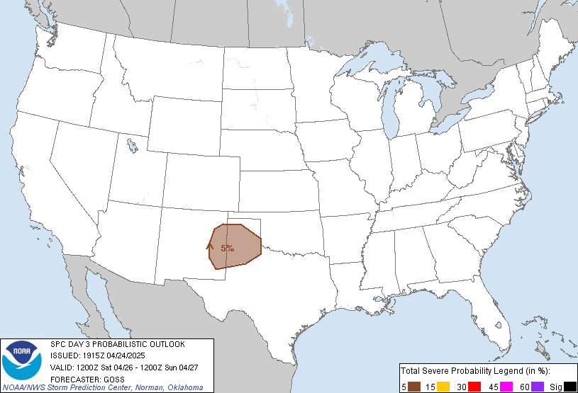
Severe thunderstorms are possible from the eastern Dakotas into the Upper Mississippi Valley as well as across portions of the Mid-Atlantic and New England region.
Outlook Images
Detailed Outlook
SPC AC 251923
Day 3 Convective Outlook NWS Storm Prediction Center Norman OK 0223 PM CDT Fri Jul 25 2025
Valid 271200Z - 281200Z
THERE IS A MARGINAL RISK OF SEVERE THUNDERSTORMS THE EASTERN DAKOTAS INTO PORTIONS OF THE UPPER MISSISSIPPI RIVER VALLEY AND ACROSS THE MID-ATLANTIC AND PORTIONS OF NEW ENGLAND
### SUMMARY
Severe thunderstorms are possible from the eastern Dakotas into the Upper Mississippi Valley as well as across portions of the Mid-Atlantic and New England region.
Synopsis
An upper ridge currently over the Southeast will gradually shift west over the next 48-72 hours into the south-central U.S. Strong/severe thunderstorm chances will largely be focused on the north/northeastern periphery of the ridge as shortwave impulses embedded within strong westerly mid-level flow overspread buoyant air masses.
Eastern Dakotas into the Upper MS Valley
Forecast confidence remains low for Sunday across the eastern Dakotas into portions of the upper MS Valley. A low-amplitude mid-level wave is forecast to round the apex of the mid-level ridge through the afternoon/evening across ND/MN. A residual MCS from overnight Saturday may accompany this wave, though the intensity of this MCS by Sunday morning remains uncertain. However, this will have a direct impact on thunderstorm development/evolution Sunday afternoon. Several deterministic solutions (most notably recent NAM and ECMWF runs) suggest either a re-intensification of the MCS and/or new convective development along an outflow boundary across MN by late afternoon. Given forecast MLCAPE of 3000-4000 J/kg and 30-40 knots of deep-layer wind shear, this activity could strengthen into a well-organized, severe MCS through the late evening hours as it propagates southeastward along a warm frontal zone into parts of IA and/or WI. Other solutions, including the high-res RRFS, depict a weaker early-morning MCS and more limited thunderstorm coverage through late evening. Ensemble guidance shows similarly dichotomous solutions. Severe risk probabilities were maintained as-is given then spread in solutions, but higher risk highlights will likely be needed if guidance begins to coalesce around the NAM/ECMWF solutions.
Mid-Atlantic into parts of New England
A weak surface trough/cold front is forecast to push eastward across the Northeast/Mid-Atlantic region through peak heating. A moist air mass will likely remain in place through the weekend and will promote widespread MLCAPE values of at least 1000 J/kg along with limited capping. West/northwesterly flow aloft coupled with modest low-level winds should support adequate deep-layer wind shear for a few strong/severe thunderstorms as convection develops by mid/late afternoon.
..Moore.. 07/25/2025
CLICK TO GET WUUS03 PTSDY3 PRODUCT
NOTE: THE NEXT DAY 3 OUTLOOK IS SCHEDULED BY 0730Z
National Risk Overview
- Friday, July 25
- TORNADO: 5%
- HAIL: 15%
- WIND: 15%
- Saturday, July 26
- TORNADO: 2%
- HAIL: 5%
- WIND: 5%
- Sunday, July 27
- ANY SEVERE: 5%
- Monday, July 28
- ANY SEVERE: predictability too low
- Tuesday, July 29
- ANY SEVERE: predictability too low
- Wednesday, July 30
- ANY SEVERE: predictability too low
- Thursday, July 31
- ANY SEVERE: predictability too low
- Friday, August 1
- ANY SEVERE: predictability too low
Your Severe Outlook
Hey, it looks like your location wasn't detected.
Drag the marker on the map and we'll show you the severe weather potential for a given location.
Hi, I'm Hayley. Did you know that I run this site out of my own pocket? So if you'd like to help out and you're already planning on buying something off of Amazon, why not use our Amazon Severe Weather Outlook link before you buy and we'll get a tiny portion of your purchase.
About Severe Weather Outlook . com
SWO started as a spinoff project of wickedwx, but has since replaced the site.
- tornado hq - live severe weather warnings
- cyclocane - hurricanes/typhoons/cyclones
- tornado solitaire - play cards while you monitor the US severe weather threat
- tertremo - live view of earthquakes around the world
- earthquake solitaire - get live earthquake updates as you play your favorite card game


