Severe Weather Outlook
Hayley here - Do you want to see severe weather in your calendar?
* it's like an add-on for your digital calendar NOT a paper calendar
Outlook for Friday, November 20
Outlook Images
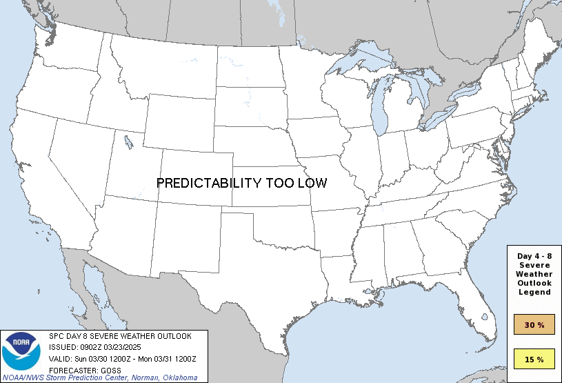
any severe predictability too low
Note on Medium Range Outlooks
You are looking at an outlook that is part of the medium range forecast (the outlook for days 4-8). The most important thing to note is that lack of a risk does not mean zero risk. Generally speaking, confidence has to be pretty high for the Storm Prediction Center to have an outlook area this far into the future.
When no specific risk areas are shown, you might see one of these phrases:
- Predictability Too Low: This means that severe storms might be possible, but forecasters aren't confident enough about where or when they might occur. Think of it as the models showing different possibilities, like pieces of a puzzle that haven't come together yet.
- Potential Too Low: This means forecasters are fairly confident that widespread severe weather is NOT expected on that day. While isolated storms might still occur, the chance of reaching severe criteria across any given area is very low.
If you bookmark this page, it will continue to update with each new outlook that is issued.
Days Covered in this Outlook
| Day 4 | Monday, November 16 | potential too low |
| Day 5 | Tuesday, November 17 | predictability too low |
| Day 6 | Wednesday, November 18 | predictability too low |
| Day 7 | Thursday, November 19 | predictability too low |
| Day 8 | Friday, November 20 | predictability too low |
Detailed Outlook
ZCZC SPCSWOD48 ALL ACUS48 KWNS 131000 SPC AC 131000
Day 4-8 Convective Outlook NWS Storm Prediction Center Norman OK 0400 AM CST Fri Nov 13 2026
Valid 161200Z - 211200Z
DISCUSSION
The upper trough across the TX Gulf Coast is forecast to continue eastward and weaken as ridging intensifies over the central US. The strong surface response to the building ridge (1030-1035 mb) will favor cool, dry and stable offshore flow over much of the CONUS. Thunderstorms will likely be confined to the near-shore coastal waters of the Gulf through the remainder of the weekend and into early next week.
Mid to late week
Ensemble guidance eventually shows the upper ridge yielding to increasingly strong western US troughing sometime mid to late week. Model solutions vary, with AINWP guidance considerably stronger and faster than physics-based ensembles with ejecting the deep upper trough and surface low D5/Tues - D7/Thur. Regardless, it appears likely that stronger southwesterly flow aloft will move eastward from the Desert Southwest into the southern Rockies and eventually the central US, with increasing thunderstorm chances mid to late week next week. The prominent high pressure over the Midwest will likely delay substantial moisture return, casting significant uncertainty on any severe potential. Predictability remains low through much of the forecast period.
..Lyons.. 11/13/2026
CLICK TO GET WUUS48 PTSD48 PRODUCT
National Risk Overview
- Friday, November 13
- TORNADO: low
- HAIL: low
- WIND: low
- Saturday, November 14
- TORNADO: low
- HAIL: low
- WIND: low
- Sunday, November 15
- ANY SEVERE: 5%
- Monday, November 16
- ANY SEVERE: potential too low
- Tuesday, November 17
- ANY SEVERE: predictability too low
- Wednesday, November 18
- ANY SEVERE: predictability too low
- Thursday, November 19
- ANY SEVERE: predictability too low
- Friday, November 20
- ANY SEVERE: predictability too low
Your Severe Outlook
Hey, it looks like your location wasn't detected.
Drag the marker on the map and we'll show you the severe weather potential for a given location.
Hi, I'm Hayley. Did you know that I run this site out of my own pocket? So if you'd like to help out and you're already planning on buying something off of Amazon, why not use our Amazon Severe Weather Outlook link before you buy and we'll get a tiny portion of your purchase.
About Severe Weather Outlook . com
SWO started as a spinoff project of wickedwx, but has since replaced the site.
- tornado hq - live severe weather warnings
- cyclocane - hurricanes/typhoons/cyclones
- tornado solitaire - play cards while you monitor the US severe weather threat
- tertremo - live view of earthquakes around the world
- earthquake solitaire - get live earthquake updates as you play your favorite card game